
Area Rides
One of the most challenging parts of a ride is simply deciding which way you're going to go! Here are a list of routes that we love and recommend. The list below includes everything from casual rides on the bike paths of Lawrence to longer distance jaunts on gravel and pavement. You will need a Strava account to download or print the directions. Strava is one of the greatest resources we've ever used and is ideal for tracking your miles, finding new routes and even finding new riding friends; and it's totally free! Don't forget to also join the Sunflower Strava Club to keep track of other riders in Lawrence community! You'll also get the inside scoop on shop events, upcoming promotions and any wild ideas we get.
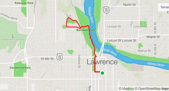
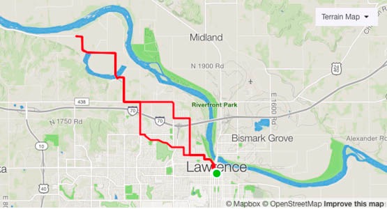
Family Ride: Outside For A Better Inside And The Kaw (3.0 miles)
Getting to the new trail along the Kansas River (The Kaw) involves some sidewalk riding along Kentucky St., but once you're on the trail it's car-free along the river and then around the old quarry (now a lake) that forms the Outside for a Better Inside Trail. Plenty of opportunities to see wildlife along the river and feel some wilderness in the heart of the City.
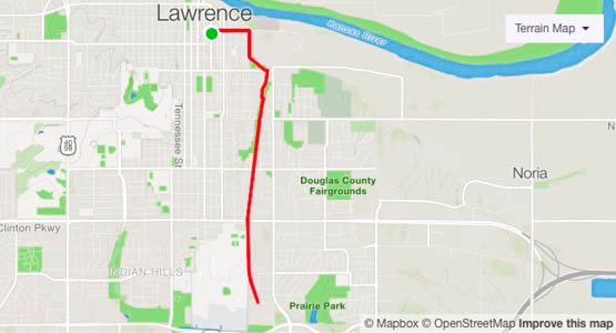
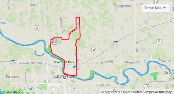
Family Ride: Burroughs Creek Trail (6.4 miles)
Riding with the family usually means finding car-free zones that offer distractions on the ride and shorter distances. The Burroughs Creek Trail, a former rail line ticks all the boxes in that regard once you get on the trail. Playgrounds, water fountains, and a railroad grade (nothing over 3%) are hallmarks of this very casual ride. Take in as much as you like and head back Downtown for some ice cream!
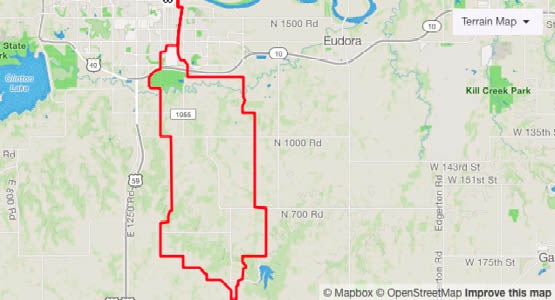
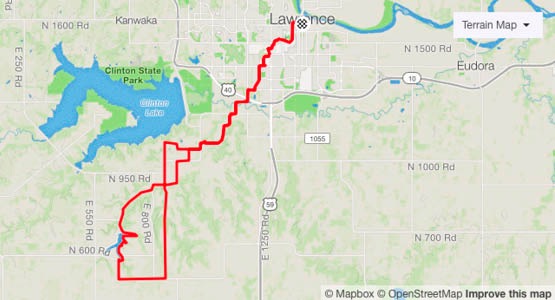
Gravel: Blue Mound Skiing, Signal Oak, & Haskell (36.9 miles)
Did you know that there used to be a skiing area in Douglas County? There was and this route will take you right by Blue Mound. It also climbs up the Signal Oak climb (home to Sunflower founders Dave & Sue Millstein) and into Baldwin before returning through the Baker Wetlands and Haskell Indian Nations University. Also out and back on the Burroughs Creek Trail.
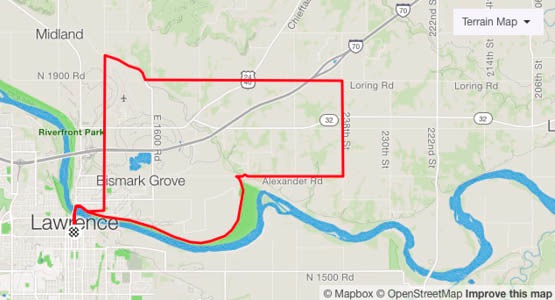
Gravel: The Shakeout Lap (19.2 miles)
This quick loop is the one we do whenever we need to shake the legs out before a big event. It starts with a spin out the levee and then further east on Alexander Rd. There are a couple of busy crossings at Hwy 32, and 24/40 so use care there, but you also get to ride a gravel road over I-70 and then get to circumnavigate the Lawrence airport. Finish it off with a beverage on the porch of Free State Brewery since it's right on the way home!
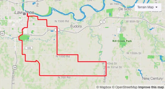
Gravel: Hastie Ridge, Chicken Creek, & Lone Star (39.5 miles)
Perfect on a day when the wind is coming out of the South, this middle-distance lap takes in the KU Campus on its way towards Lone Star Lake. On the way down there, you'll pass Hastie Hill (site of the only Mountain Bike DOWNHILL State Championship to our knowledge) and the historic Chicken Creek bridge. There's some hills on this route, but there's also some great downhills!
Gravel: Lakeview & "The Swiss Valley Road" (24.9 miles)
Ride this lap in either direction to take in some of Douglas County's most iconic roads. There's a little pavement to get out of town, and you should use caution crossing County 438, but in general it's a fairly car-free lap. The general store is open sporadically, but their coin-op soda machines are always on in Lecompton.
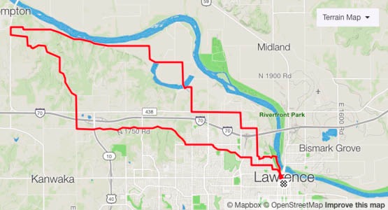
Gravel: Up Snake Farm, Down Stair Step, Levee On Both Ends (24.7 miles)
This is a classic route up into the hills of Jefferson County. Start off by heading East on the levee and then wind your way North (use caution crossing 24/40 on the way out and the way back) climbing up through the KU Biological Preserve and then back down Stair Step Rd. Best done a North wind day, this is premium gravel with all the climbing in the middle.
Road: The Vinland Valley Velodrome and The Sunflower Army Ammunition Plant (43.5 miles)
Popular among many road riders in Douglas County, this route rolls South of town and rolls through Vinland (home to a cool little airport) and then on to the Southern boundary of the old Sunflower Army Ammunition Plant. This route includes some time on busy rural roads, but ridden on a quiet weekend morning, they're relatively car free.
Road: Lakeview Out & Back (16.4 miles)
When you're short on time, this quick out and back to the Lakeview area (a cutoff oxbow of the Kansas River) is the perfect flat sojourn to get some road miles under your wheels. Ride the road until you hit gravel and then return via your route back to Downtown. A classic!
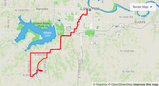
Road: Lone Star Out & Back (39.0 miles)
The quintessential road ride out to Lone Star Lake and back. This route takes in much of the weekly club ride called "The Muffin Ride" and once out of the city takes in rural county roads that are fairly low traffic, but can be busier on weekdays and certain hours of any day. Use caution and maximize your visibility, but also enjoy a route that has been used by thousands over the years.